
Discover exceptional hospitality across 18 regions — and give back with every listing.
100% of proceeds to Philippine Red Cross
What We Offer
Send Money & Load
- Send Money — free
- Send Load — free
- Ask a Question about the Philippines
Simple, no-cost services for the community.
Business Listings
- Instant Listing — ₱99.00 ($1.99), no expiration
- Free Listing — ₱0.00, unlimited submissions
- Featured Listing — ₱999.00/year ($19.99)
Dining, Lodging, Outdoor Activities, and Nightlife categories.
Philippines Gifts
- Philippines-themed gifts available
- Every purchase supports the Philippine Red Cross
Share a piece of the Philippines with someone special.
Across Every Region
From the rolling hills of the Ilocos Region and the highlands of Cordillera, through the vast Cagayan Valley and the vibrant streets of the National Capital Region, down to the pristine shores of MIMAROPA and the fiery landscapes of Bicol — Salamat Philippines brings together listings that span all 18 regions. Whether you're drawn to Western Visayas, the Negros Island Region, Central or Eastern Visayas, or the southern reaches of Zamboanga Peninsula, Northern Mindanao, Bangsamoro, Caraga, SOCCSKSARGEN, and Davao Region, there is something here waiting to be discovered.
Featured listings have included Herbie's Catering & Events (serving since 2007, phone 0915-3545079, 59 Acapulco), ABC Hotel (phone +63 45 892 2222, Don Juico Avenue), and the BenCab Museum (phone +63 74 442 7165, Km 6 Asin Road). Browse, upvote your favorites, and sign the guest book to say Salamat.
Hiking Through The Sierra Madre Mountains
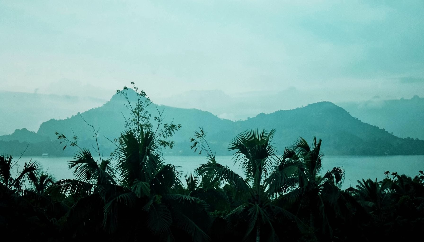
The Sierra Madre is the longest mountain range in the Philippines, running along much of eastern Luzon beside the Pacific Ocean. Its forested slopes, limestone ridges, waterfalls, river valleys, and coastal views create a wide variety of hiking experiences. Some routes are suitable for a half-day escape from Metro Manila, while others require camping, local guides, and strong preparation.
The range is not a single destination with one uniform trail system. Conditions change between Rizal, Bulacan, Quezon, Aurora, and Isabela. A short climb near Rodriguez may involve exposed limestone and scrambling, while a more remote Aurora route can mean dense forest, river crossings, and limited mobile reception. Understanding that difference is essential when choosing a mountain adventure.
Many trailheads are close enough to combine with a weekend itinerary. Travelers can pair a morning hike with riverside swimming, a local food stop, or a visit to a nearby town. The experience also becomes more rewarding when hikers treat every route as part of a living landscape rather than simply a viewpoint reached for a photograph.
Why This Mountain Range Rewards Hikers
The western side of the Sierra Madre is especially accessible from Metro Manila. Rizal and Bulacan offer popular day hikes, often with early-morning departures and manageable travel times. Their trails are known for jagged rock formations, grassy summits, bamboo sections, and broad views over lowland communities.
Farther north and east, the character of the mountains becomes wilder. Aurora’s forested interiors receive Pacific weather and can be wet even when conditions look clear in Manila. Routes in this area may pass through streams, old-growth vegetation, and steep ridgelines with few commercial facilities. The extra effort brings quieter surroundings and a stronger sense of isolation.
The Sierra Madre also supports important watersheds and habitats. The range is associated with Philippine wildlife, including species that depend on large forest corridors. Hiking responsibly means staying on established paths, carrying waste out, avoiding loud behavior near wildlife, and respecting restrictions designed to protect sensitive areas.
Accessible Routes Around Rizal And Bulacan
Mount Daraitan in Tanay, Rizal, is among the most recognizable hiking destinations in the range. The trail climbs through forest and rocky terrain toward a summit with views of the Sierra Madre, Laguna de Bay, and surrounding valleys on clear days. The route is moderately demanding, with steep sections that become slippery during rain. Many hikers extend the trip to Tinipak River, where striking limestone formations and cool water create a memorable second stop.
Rodriguez, formerly Montalban, has several well-known limestone hikes. Mount Pamitinan is a relatively short but steep climb with exposed rock, narrow passages, and panoramic views across Rizal. Its surroundings also carry historical importance, and local guides can explain the mountain’s connection with revolutionary activity and regional folklore. Hapunang Banoi and Mount Ayaas provide longer, more strenuous alternatives in the same broad area, with scrambling and open ridgelines adding difficulty.
Mount Balagbag, near the Bulacan–Rizal boundary, is a popular choice for hikers seeking a broad summit and a straightforward day outdoors. The landscape includes rolling grassland, dirt roads, and viewpoints over the surrounding hills. It is less forested than some eastern routes, so sun protection becomes important. The mountain’s accessibility can also mean heavier weekend foot traffic, particularly during favorable weather.
For visitors who enjoy combining outdoor activities with urban heritage, a separate Manila walking itinerary can add cultural depth before or after a mountain trip. The Intramuros walking tour offers a useful contrast to the rugged landscapes of Rizal, moving from Spanish-era walls and historic streets to the natural terrain beyond the capital.
Longer And More Remote Mountain Adventures
Mount Irid is a more serious undertaking than the short day hikes near Manila. Rising in the northern Rizal area, it is associated with thick forest, steep slopes, muddy sections, and changing weather. Depending on the route and current trail conditions, the climb may require a long day or an overnight stay. It should be approached with a registered guide, reliable navigation, and enough food and water for delays.
The mountains of Dingalan and other parts of Aurora offer a different kind of Sierra Madre experience. Routes around Mount Mingan and nearby forested peaks can involve dense vegetation, creek crossings, slippery ground, and limited infrastructure. These hikes are better suited to experienced trekkers who are comfortable moving at a slower pace and adapting to changing conditions.
Remote trails should never be judged by elevation alone. A lower mountain with rain-softened soil, tangled roots, or repeated river crossings can be harder than a taller but well-maintained peak. Travel time, evacuation access, weather exposure, and guide availability are all part of the difficulty rating.
| Trail or Area | Best For | Typical Character | Main Considerations |
|---|---|---|---|
| Mount Daraitan and Tinipak | First major Sierra Madre hike | Forest, limestone, river scenery | Steep sections, crowds, registration |
| Mount Pamitinan | Short adventure near Manila | Exposed rock, scrambling, viewpoints | Heat, narrow passages, guide requirements |
| Hapunang Banoi | Strong day hikers | Rocky ridges and demanding climbs | Slippery surfaces and sun exposure |
| Mount Ayaas | A quieter Rizal option | Forest paths and open slopes | Confirm current access and trail rules |
| Mount Balagbag | Beginners and casual groups | Grassland, roads, wide summit views | Limited shade and weekend traffic |
| Mount Irid | Experienced trekkers | Dense forest and rugged terrain | Long approach, weather, overnight planning |
| Aurora mountain routes | Backcountry hikers | Forest, streams, remote ridges | Limited facilities and communications |
Choosing A Trail For Your Group
A first-time group should begin with a route that matches its least experienced member. Mount Balagbag or a guided Mount Pamitinan outing may be more appropriate than an ambitious attempt on Mount Irid. Mount Daraitan can be a strong next step for hikers who have completed shorter climbs and are prepared for steep, uneven terrain.
Fitness is only part of the decision. Someone comfortable with long road walks may still struggle with exposed limestone, while a strong climber may find humid forest conditions exhausting. Ask local organizers about current conditions, required equipment, registration procedures, and turnaround times instead of relying on old social media posts.
Seasonal timing matters throughout the range. The dry season can make trails easier to walk, but heat and dehydration become serious risks on exposed slopes. Rain can transform dirt paths into mud and raise river levels quickly. A clear forecast for the city does not guarantee safe conditions in the mountains, especially on the Pacific-facing side.
Planning A Safe And Responsible Hike
Start early whenever the route allows it. An early departure reduces exposure to midday heat, leaves more time for a slow group member, and provides a buffer if transport is delayed. It also improves the chance of reaching a viewpoint before clouds build over the ridges.
Pack water according to the route, expected heat, and availability of refill points. A basic kit should include trail shoes with dependable grip, sun protection, rain gear, a headlamp, first-aid supplies, food, personal medication, and a fully charged phone. A power bank and an offline map are valuable when reception becomes unreliable.
Local registration and guiding systems are part of responsible mountain travel. Fees often support trail maintenance, community administration, or local employment. Follow instructions about swimming areas, camping zones, fires, and restricted sections. Keep valuables secure during transport, and arrange return travel before beginning a hike where public vehicles are infrequent.
Weather should determine whether the hike proceeds. Postpone a climb when thunderstorms, landslides, swollen rivers, or severe rain create unacceptable risks. No viewpoint is worth pushing through dangerous conditions, and turning around early is a normal part of good mountain judgment.
Nature, Heritage, And The Wider Itinerary
The Sierra Madre is valuable because of what surrounds its trails as well as what appears at the summit. Forests feed streams and farms, while mountain communities preserve knowledge about plants, weather, routes, and local history. Hiring community-based guides gives visitors a safer experience and helps keep tourism income near the trailhead.
Travelers should avoid collecting rocks, flowers, shells, or plants. Limestone formations can look durable but are easily damaged by climbing chalk, graffiti, and repeated foot traffic. Use established paths, keep music low, and give wildlife space. Leave no food scraps, since animals that become accustomed to hikers may face long-term harm.
A mountain weekend can include other destinations without becoming rushed. Visitors based in the south may add a food or sightseeing stop around Tagaytay, where Instagrammable Tagaytay spots offer a very different landscape of ridges, cafés, and lake views. Those looking for trip logistics, accommodations, activities, or dining venues can also browse regional listings before setting out.
The strongest itineraries leave room for local spending. Eat at a community-run venue, use accredited transport, and purchase supplies near the municipality when possible. This spreads the benefits of hiking beyond the summit and recognizes the residents who maintain access to the mountains.
Smart Choices For A Better Mountain Day
A well-planned route makes the experience safer, more comfortable, and more respectful to the communities along the way.
- Choose the trail according to the group’s actual experience, not the most impressive photograph.
- Confirm registration, guide requirements, road access, fees, and current closures shortly before departure.
- Carry enough water, food, sun protection, rain gear, first-aid supplies, and a headlamp for delays.
- Use reusable containers, pack out every item, and avoid damaging vegetation or rock formations.
- Set a turnaround time and follow the guide’s advice when weather or trail conditions deteriorate.
Record emergency contacts and share the itinerary with someone who is not joining the hike. If a group becomes separated, stop at a safe location rather than allowing individuals to continue alone. Simple procedures are especially important in areas where mobile reception disappears.
Bring a patient pace to the trail. The goal is to experience the forest, geology, views, and communities of the Sierra Madre while leaving the route in good condition for the next group. Browse Salamat Philippines for nearby stays, restaurants, attractions, and outdoor listings, then build a practical itinerary that supports local businesses and responsible travel.

Get in Touch
Connect with Salamat Philippines on social media or send a message. We'd love to hear from you.
Facebook: /salamatphilippines
Twitter: @salamatphil
Instagram: @salamatphilippines
YouTube: salamat-philippines
LinkedIn: company/salamat-philippines
Email: [email protected]