
Discover exceptional hospitality across 18 regions — and give back with every listing.
100% of proceeds to Philippine Red Cross
What We Offer
Send Money & Load
- Send Money — free
- Send Load — free
- Ask a Question about the Philippines
Simple, no-cost services for the community.
Business Listings
- Instant Listing — ₱99.00 ($1.99), no expiration
- Free Listing — ₱0.00, unlimited submissions
- Featured Listing — ₱999.00/year ($19.99)
Dining, Lodging, Outdoor Activities, and Nightlife categories.
Philippines Gifts
- Philippines-themed gifts available
- Every purchase supports the Philippine Red Cross
Share a piece of the Philippines with someone special.
Across Every Region
From the rolling hills of the Ilocos Region and the highlands of Cordillera, through the vast Cagayan Valley and the vibrant streets of the National Capital Region, down to the pristine shores of MIMAROPA and the fiery landscapes of Bicol — Salamat Philippines brings together listings that span all 18 regions. Whether you're drawn to Western Visayas, the Negros Island Region, Central or Eastern Visayas, or the southern reaches of Zamboanga Peninsula, Northern Mindanao, Bangsamoro, Caraga, SOCCSKSARGEN, and Davao Region, there is something here waiting to be discovered.
Featured listings have included Herbie's Catering & Events (serving since 2007, phone 0915-3545079, 59 Acapulco), ABC Hotel (phone +63 45 892 2222, Don Juico Avenue), and the BenCab Museum (phone +63 74 442 7165, Km 6 Asin Road). Browse, upvote your favorites, and sign the guest book to say Salamat.
Landscape photography in the Cordillera highlands
The Cordillera Administrative Region is one of the Philippines’ richest destinations for landscape photography. Its mountain roads climb through pine forests, cloud-filled valleys, stone villages and ancient rice terraces, creating scenes that change dramatically with the weather. For photographers, the appeal lies in the variety: a single day can move from misty ridgelines to sharp afternoon light and a glowing sunset over cultivated slopes.
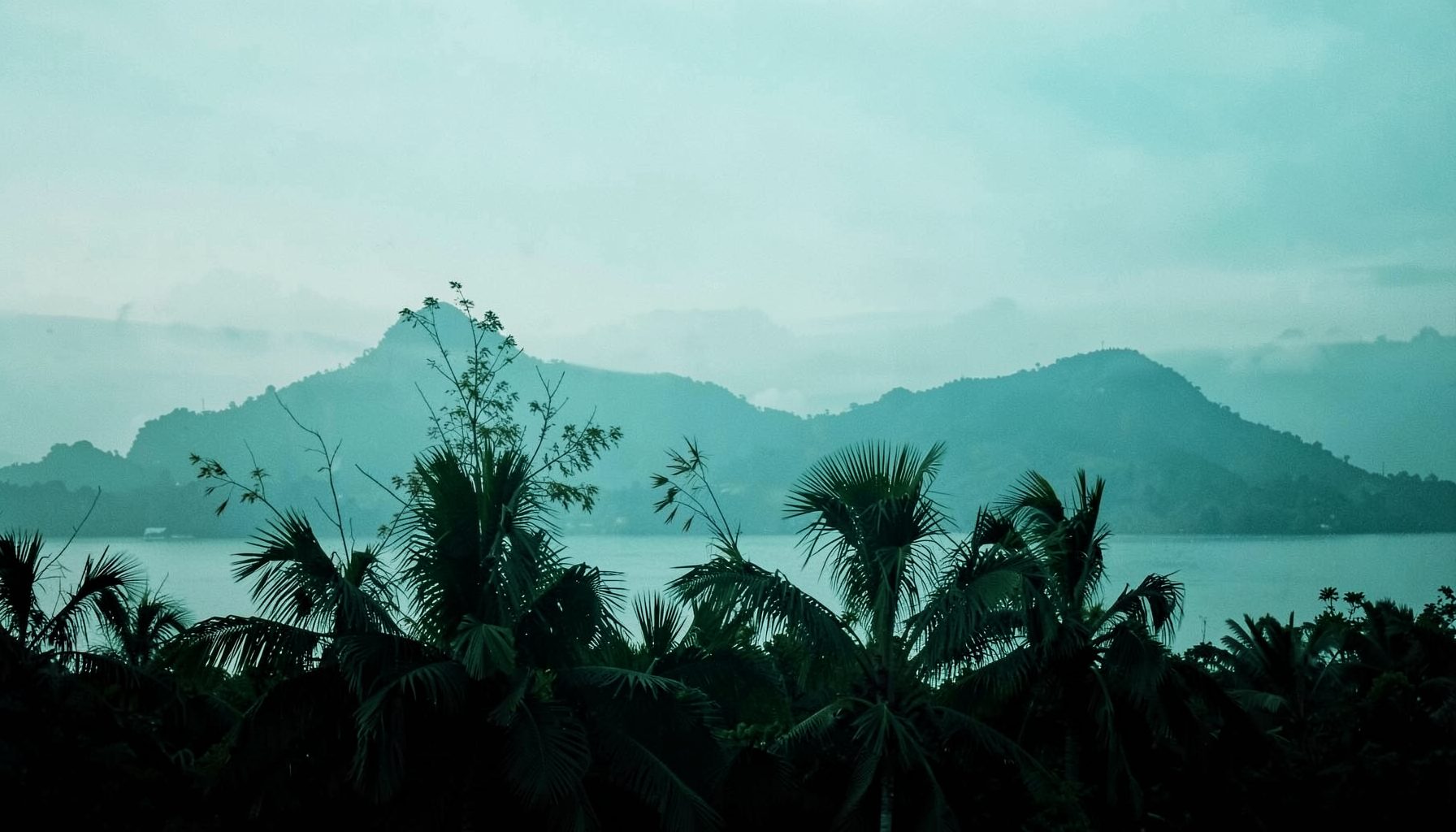
The region rewards patience more than a rushed sightseeing itinerary. Sunrise may arrive behind a veil of fog, then reveal layers of mountains minutes later. Wet-season clouds can obscure a viewpoint before transforming it into a moody, atmospheric frame. Dry-season skies often provide clearer horizons, although haze and strong midday contrast can still affect distant compositions.
For travellers from Australia, the Cordillera feels close enough for a serious holiday yet different from familiar alpine or coastal landscapes. There is generally no simple direct flight from Sydney, Melbourne or Brisbane to the mountain towns, so most trips begin with a flight to Manila followed by a long road transfer or a domestic connection to nearby airports. Planning extra time is worthwhile, especially when the aim is to photograph golden-hour light rather than simply tick off viewpoints.
Banaue and Batad rice terraces
Banaue is the natural starting point for photographing the Ifugao rice terraces, often described as a living cultural landscape rather than a static monument. From the main viewpoints, the terraces sweep across steep valleys in repeating contours. Early morning is usually the best time for softer contrast, cooler colours and a greater chance of seeing clouds settle between the ridges.
The Banaue Viewpoint beside the main road offers a broad scene, but photographers should also spend time exploring smaller roadside pull-offs and village paths with local guidance. These positions reveal details that a standard panorama can miss: a farmer walking along a narrow terrace wall, a cluster of traditional houses, or rainwater reflecting the sky in the paddies. A telephoto lens around 70–200mm is useful for compressing the layered slopes, while a wide lens can show the scale of the valley.
Batad provides a more enclosed and dramatic composition. Its amphitheatre-shaped terraces require a hike down from the road, followed by a climb back out, so sturdy footwear and a sensible camera bag matter. The famous viewpoint above Tappiya Falls is rewarding, yet the trail itself contains quieter frames of stone walls, forested slopes and changing agricultural textures. Rice planting and harvest seasons alter the colour palette, with fresh green paddies giving way to golden fields at other times of year.
These terraces are working farms and culturally important places. Avoid stepping onto walls or entering fields without permission, and ask before photographing residents at close range. A local guide can explain access routes, seasonal conditions and where visitors should stand. Salamat Philippines’ regional travel directory can also help travellers discover accommodation, guides and other local services while building a wider itinerary.
Sagada cliffs, caves and mountain light
Sagada has a different visual character from Banaue. Its landscape combines limestone formations, pine-covered hills, hanging coffins, caves and deep valleys often filled with morning mist. The town’s elevated setting makes it especially attractive for atmospheric photography, although access to several cultural and natural sites is managed through local tourism offices and accredited guides.
The sunrise viewpoint at Kiltepan is one of the region’s best-known locations. On a clear morning, the sun rises behind distant mountain layers while fog pools across the valley below. Conditions are unpredictable, so arriving before dawn does not guarantee a view. That uncertainty is part of the experience: a blank white sea of cloud can produce a minimalist image, while a sudden opening may reveal dramatic depth and warm sidelight.
Photographers should also consider Echo Valley and the surrounding trails. Limestone edges, tall pines and textured rock create strong foreground elements for compositions that do not depend on a famous overlook. Inside Sumaguing Cave, photography becomes a technical exercise involving low light, slippery surfaces and restricted movement. A waterproof camera cover, headlamp and compact tripod can be more useful than a large collection of lenses.
Sagada is cooler than much of the lowland Philippines, but its roads and trails still become wet and muddy. Australian visitors accustomed to marked bush tracks in places such as the Blue Mountains should expect a more informal trail environment, uneven steps and locally arranged access. Pack water, allow extra time and follow guide instructions around cliffs, caves and culturally significant sites.
Mount Pulag and the sea of clouds
Mount Pulag is the highest peak in Luzon and one of the Cordillera’s most sought-after sunrise locations. The summit area is known for dwarf bamboo grasslands, rolling ridges and the possibility of a sea of clouds stretching below the trail. When the weather cooperates, first light moves across the ridgelines in layers, offering a broad panorama that suits both wide-angle and stitched panoramic images.
The climb begins well before sunrise, often in cold, windy conditions. Temperatures can feel surprisingly low for travellers arriving from Australia’s warmer cities, particularly while waiting motionless for the first light. A proper insulating layer, waterproof shell, gloves and a head torch are essential. The summit may be clear while lower slopes remain covered in cloud, or the entire ridgeline may disappear into fog.
Access is regulated to protect the mountain environment. Registration, guide arrangements and route restrictions can apply, and requirements may change according to weather, conservation concerns or local management decisions. It is important to check current rules before travelling rather than relying on an old blog post. Camping and hiking groups should carry out all rubbish and avoid damaging the fragile vegetation around established paths.
The Ambangeg route is often regarded as the most accessible option, but “accessible” still means a demanding highland trek for many visitors. Australian bushwalkers may compare the preparation with a cool-weather overnight walk in Tasmania, though the altitude, tropical conditions and transport arrangements are different. Build in time for acclimatisation and avoid treating the mountain as a quick photo stop.
Atok gardens and Benguet highlands
Atok, in Benguet province, offers highland scenery that is more open and agricultural than the forested approaches to Sagada. Vegetable farms, flower gardens, pine slopes and ridges create a patchwork of colour. The area is particularly attractive when low clouds drift across the hills, giving photographs a sense of depth and movement.
Haight’s Place and nearby elevated viewpoints are popular for broad mountain compositions, while Northern Blossom Flower Farm is known for cultivated blooms set against Benguet’s rugged terrain. Visitors should check opening arrangements and photography policies before arriving, since farms operate as businesses and may restrict professional shoots, drones or particular areas. A colourful garden can be visually strong, but the surrounding roads and hills often provide more distinctive regional context.
Atok is also a good place to practise working with changing light. The high elevation can produce crisp morning shadows, bright midday colour and quick cloud cover in the afternoon. Instead of photographing every subject from the same height, try including a foreground of flowers, terraces or roadside vegetation and allowing the mountain layers to recede behind it.
The roads can be narrow, winding and slow, especially when trucks share the route with vans and local traffic. A private vehicle with an experienced driver can make sunrise and sunset plans easier than relying on fixed public transport. Australian travellers should also remember that driving conventions differ, and a Philippine mountain road demands more attention than a relaxed regional drive along the Great Ocean Road.
Baguio, pine forests and nearby viewpoints
Baguio is the practical gateway for many Cordillera journeys and a worthwhile photography destination in its own right. Its pine forests, steep urban streets and cooler climate give it a distinct visual identity. Early morning around Camp John Hay can produce shafts of light through the trees, while Mines View Park and nearby ridges offer views across densely built slopes.
The city is busy, especially during weekends, holidays and the annual Panagbenga flower festival. That activity can be useful for street and cultural photography, but it also means that famous viewpoints may be crowded. Arriving early gives photographers cleaner sightlines and gentler light. Traffic can be slow, so a location that looks close on a map may take much longer to reach than expected.
Baguio works well as a base for photographers who want reliable accommodation, restaurants, cafés and mobile connectivity before heading deeper into the mountains. It is also a sensible place to organise cash, fuel, data and transport. Australian visitors should carry some Philippine pesos for smaller businesses and rural services, even if they use an Australian bank card in larger hotels. Foreign transaction fees, ATM limits and intermittent card acceptance can affect a tightly scheduled shoot.
The city’s surrounding landscape is changing under development pressure, so compositions that focus only on untouched wilderness can give an incomplete picture. Try including layers of homes, roads and pine trees to show how people inhabit the mountains. Respect private property and avoid blocking narrow streets while setting up a tripod.
Planning a responsible photography trip
Timing is central to landscape photography in the Cordillera. The dry season can offer more dependable access, but the wet season brings saturated greens, waterfalls and powerful cloud formations. Typhoons and heavy rain may disrupt roads, hiking routes and domestic transport. Build flexibility into the itinerary rather than booking every night around a single sunrise.
A practical route might connect Baguio, Atok, Banaue and Sagada, although travel times are longer than map distances suggest. Mountain roads are winding, and shared vans may stop frequently. A private car and driver provide better control over dawn departures and equipment, while public transport can be affordable and more sociable. Leave room for delays, especially when connecting with a flight or an international departure from Manila.
Camera protection matters in this climate. Bring dry bags, silica gel, lens cloths, spare batteries and a lightweight rain cover. Condensation can form when cold equipment moves into a warm, humid room, so allow the camera to acclimatise inside a sealed bag. A polarising filter can manage reflections and deepen skies, though it should be used carefully when photographing broad mountain layers.
Good preparation also includes practical travel research. Australians living in or visiting the Philippines may find banking and payment arrangements unfamiliar, and this expat banking guide explains considerations that can affect longer stays. Travel insurance should cover hiking at the intended altitude, while a local SIM or eSIM helps with maps, weather updates and contacting drivers.
Finally, photography should support the places being photographed. Use established paths, keep noise low at sunrise, avoid flying a drone near homes or crowds, and seek permission for portraits. Buying food, accommodation and guiding services locally spreads the value of tourism through mountain communities. The strongest images from the Cordillera usually come with an understanding of its farms, forests and people, rather than treating the landscape as scenery detached from everyday life.

Get in Touch
Connect with Salamat Philippines on social media or send a message. We'd love to hear from you.
Facebook: /salamatphilippines
Twitter: @salamatphil
Instagram: @salamatphilippines
YouTube: salamat-philippines
LinkedIn: company/salamat-philippines
Email: [email protected]