
Discover exceptional hospitality across 18 regions — and give back with every listing.
100% of proceeds to Philippine Red Cross
What We Offer
Send Money & Load
- Send Money — free
- Send Load — free
- Ask a Question about the Philippines
Simple, no-cost services for the community.
Business Listings
- Instant Listing — ₱99.00 ($1.99), no expiration
- Free Listing — ₱0.00, unlimited submissions
- Featured Listing — ₱999.00/year ($19.99)
Dining, Lodging, Outdoor Activities, and Nightlife categories.
Philippines Gifts
- Philippines-themed gifts available
- Every purchase supports the Philippine Red Cross
Share a piece of the Philippines with someone special.
Across Every Region
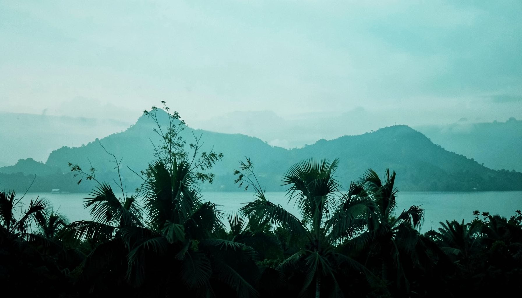
From the rolling hills of the Ilocos Region and the highlands of Cordillera, through the vast Cagayan Valley and the vibrant streets of the National Capital Region, down to the pristine shores of MIMAROPA and the fiery landscapes of Bicol — Salamat Philippines brings together listings that span all 18 regions. Whether you're drawn to Western Visayas, the Negros Island Region, Central or Eastern Visayas, or the southern reaches of Zamboanga Peninsula, Northern Mindanao, Bangsamoro, Caraga, SOCCSKSARGEN, and Davao Region, there is something here waiting to be discovered.
Featured listings have included Herbie's Catering & Events (serving since 2007, phone 0915-3545079, 59 Acapulco), ABC Hotel (phone +63 45 892 2222, Don Juico Avenue), and the BenCab Museum (phone +63 74 442 7165, Km 6 Asin Road). Browse, upvote your favorites, and sign the guest book to say Salamat.
A Complete Guide To Hiking Mount Apo From The Kidapawan Trail
Mount Apo, the highest mountain in the Philippines, rises to approximately 2,954 meters above sea level in Mindanao. Its summit landscape combines dense tropical forest, volcanic terrain, highland grass, moss-covered trees, cold mountain air, and broad views across Davao and Cotabato. The Kidapawan Trail is one of the best-known approaches to the peak and is often chosen for its varied scenery and established trekking culture.
A successful Mount Apo climb requires more than physical fitness. Access rules, weather, permits, local guide arrangements, transport, camping equipment, and environmental regulations can change by season or local authority. Treat the journey as a guided expedition rather than an ordinary day hike, and verify conditions with the local tourism office, protected-area authorities, and an accredited guide before departure.
The route is commonly completed in three days and two nights, although itineraries vary according to weather, group pace, trail conditions, and the selected campsite. The details below provide a practical framework for planning a Kidapawan-side ascent while leaving room for current instructions from local officials.
Why The Kidapawan Route Is Worth Choosing
The Kidapawan approach begins in or near Barangay Ilomavis, within the Mount Apo Natural Park area. The exact trailhead and transport arrangements depend on current access permissions, but the route generally leads hikers through lowland settlements, cultivated areas, forest, river crossings, and increasingly rugged upland terrain. This progression makes the climb feel like a journey through several ecological zones rather than a single steep walk.
Many hikers value the trail for its recognizable landmarks. Depending on the itinerary and current route, these may include forest camps, the boulder section, Lake Venado, mossy forest, sulfur-scented areas, and the summit ridge. Lake Venado is frequently used as a high-altitude campsite, although its condition, accessibility, and camping rules can vary. The boulder area is another memorable section, requiring careful footing over large volcanic rocks and uneven ground.
The route also offers meaningful community interaction. Local guides, porters, transport providers, homestays, and small food businesses support many climbs. Hiring local services through legitimate channels helps distribute tourism income and gives visitors a better understanding of the mountain’s cultural and environmental importance.
Permits, Guides, And Travel Arrangements
Mount Apo is a protected natural area, so hikers normally need registration, an environmental or entrance fee, and permission from the relevant local authorities. Requirements may be coordinated through the Kidapawan City tourism office, the protected-area management board, a registered tour operator, or an authorized local guide. Policies can change because of weather closures, conservation work, fire risk, landslides, or community decisions.
A local guide is essential for route-finding, emergency coordination, river crossings, campsite procedures, and communication with communities along the trail. A guide can also explain restrictions on collecting plants, entering sensitive areas, washing near water sources, or camping outside designated locations. Porters may be available, but their rates, load limits, food arrangements, and booking procedures should be agreed upon in advance.
Build a travel schedule with a buffer day. Reaching the trailhead may involve flights or buses to Mindanao, road travel toward Kidapawan, and a final transfer to the jump-off point. Delays are possible during heavy rain, and a summit attempt may be postponed when wind, lightning, low visibility, or slippery terrain creates unacceptable risk. Confirm whether transport, permits, meals, camping equipment, and guide fees are included in any package.
For local updates, use official tourism and protected-area channels rather than relying solely on old social media posts. Travelers who want to share route experiences or discover related community information can also visit the guest book, especially when documenting recent conditions for future visitors.
A Typical Three-Day Hiking Schedule
Most organized climbs from the Kidapawan side follow a three-day, two-night plan. On the first day, hikers travel from Kidapawan to the authorized trailhead, complete registration, and begin walking through the lower portions of the route. The first stage may feel warm and humid, while the trail gradually becomes cooler and more shaded. Depending on the permitted itinerary, the group camps at a designated forest or upland site.
Day two is usually the most demanding. The route may include extended ascents, muddy sections, exposed roots, river crossings, and the boulder field. Hikers often leave camp well before dawn or begin their summit push during the early morning, depending on the guide’s plan. Lake Venado or another authorized high camp may serve as a staging point. Pacing is more important than speed because altitude, heavy packs, and uneven ground can quickly drain energy.
The final day normally includes the summit attempt, descent to a lower campsite or trailhead, and transport back toward Kidapawan. Some groups summit on the second day and descend on the third, while others use a longer four-day itinerary to reduce fatigue. A slower schedule can be safer and more enjoyable for first-time high-altitude trekkers, especially when the group includes people with limited mountain experience.
| Planning Area | What To Expect | Practical Approach |
|---|---|---|
| Typical duration | Three days and two nights, with longer options available | Add a spare day for weather or transport delays |
| Trail surface | Soil, roots, mud, river crossings, volcanic boulders, and grassland | Wear footwear with secure traction and ankle support |
| Highest section | Cold, windy, and sometimes foggy near the summit | Carry warm layers even when the lowlands are hot |
| Navigation | Route conditions and access points can change | Stay with an authorized guide and group |
| Camping | Designated sites may be basic and exposed | Bring a suitable sleeping system and waterproof protection |
| Water and food | Sources may be seasonal or require treatment | Confirm resupply plans and carry backup water capacity |
| Main hazards | Slips, hypothermia, lightning, altitude symptoms, and exhaustion | Follow the guide’s pace and turn-around decisions |
Trail Conditions And Physical Preparation
The Kidapawan Trail is demanding because of its length, elevation gain, and changing surfaces. A hiker may move from hot, wet conditions into cold cloud forest within the same day. Rain can turn soil into deep mud, swell streams, and make boulders dangerously slick. Dry weather does not eliminate difficulty; dust, loose rock, heat, and direct sun can still increase fatigue.
Prepare with regular walking and climbing sessions several weeks before the trek. Long weekend hikes are useful, but include stair training, uphill intervals, and walks carrying a gradually increasing pack. Strength work for the legs, hips, back, and core can improve stability on uneven terrain. Practice using trekking poles and walking in the footwear you intend to wear, since new boots can cause blisters at the worst point of the climb.
Altitude affects people differently. Mount Apo is high enough for some hikers to experience headache, nausea, dizziness, unusual tiredness, poor sleep, or shortness of breath. Fitness does not guarantee immunity. Ascend steadily, drink sensibly, eat regularly, and tell the guide immediately if symptoms worsen. Confusion, difficulty walking, persistent vomiting, severe headache, or breathing problems require urgent descent and medical attention.
Gear, Food, And Campsite Comfort
A waterproof backpack liner or dry bags are among the most useful items on a Mount Apo trek. Tropical rain can arrive suddenly, and wet clothing or sleeping gear becomes a serious problem in cold highland conditions. Pack a rain jacket, pack cover, quick-drying layers, warm insulation, spare socks, gloves, a beanie, and a reliable headlamp with extra batteries.
Footwear should match the terrain and the hiker’s experience. Trail shoes may work for confident hikers in favorable conditions, while boots can provide additional ankle protection in mud and boulder sections. Trekking poles help with balance during steep descents and slippery crossings. A basic personal first-aid kit should include blister treatment, personal medication, antiseptic supplies, and any medicines approved for the individual’s health needs.
Food arrangements differ among guides and tour packages. Ask whether meals are cooked by the organizing team, carried by porters, purchased in communities, or supplied by each hiker. Carry compact snacks such as nuts, dried fruit, energy bars, crackers, or sandwiches. Water should be treated or filtered unless the guide confirms that a source is safe. Avoid assuming that every stream is potable, especially near campsites or agricultural areas.
Camps may be simple, crowded, windy, or damp. A sleeping bag rated for cool conditions, an insulating sleeping mat, and a tent with effective rain protection make a major difference. Keep electronics and documents in waterproof pouches. Pack out every item you bring, including food wrappers, tissues, batteries, and damaged gear.
Responsible Trekking And Safety Practices
Mount Apo is ecologically sensitive and culturally significant. Stay on authorized paths, follow campsite rules, and avoid picking plants, disturbing wildlife, carving trees, or taking volcanic rocks as souvenirs. Keep noise low, especially around camps and forest habitats. Human waste must be managed according to local instructions, and hikers should never contaminate lakes, streams, or springs with soap or waste.
Weather awareness is central to safety. Thunderstorms, strong winds, fog, heavy rain, and sudden temperature drops can affect the summit ridge and exposed boulder areas. A summit view is never worth pressing forward into dangerous conditions. The guide or local authority may cancel a climb, change the itinerary, or order a retreat; treat those decisions as part of responsible mountain management.
Before leaving, give a trusted person your itinerary, guide details, emergency contacts, and expected return time. Carry a charged phone, power bank, whistle, basic first-aid supplies, identification, cash, and any required permits. Mobile service may be unreliable, so do not depend on a phone for navigation or emergency communication.
Practical Checks Before Departure
- Confirm trail opening dates, permit requirements, fees, and the authorized jump-off point.
- Book a registered local guide and clarify transport, porter service, meals, tents, and cancellation terms.
- Train with hills or stairs while carrying a light-to-moderate pack.
- Prepare waterproof clothing, warm layers, traction footwear, water treatment, and personal medication.
- Agree on a turn-around plan and respect decisions based on weather, health, or trail safety.
Getting To Kidapawan And Building The Trip
Kidapawan can serve as the practical base for transport, supplies, overnight accommodation, and final guide coordination. Travelers arriving from outside Mindanao usually need to connect through a major regional gateway before continuing by road. Travel times depend heavily on the starting city, traffic, weather, and road conditions, so avoid scheduling a same-day arrival immediately before the climb.
Spend time checking what is available in Kidapawan before heading into the mountains. Refill water, withdraw cash, purchase forgotten essentials, and confirm the meeting point with the trekking organizer. A local overnight stay can make the beginning of the hike less stressful than attempting a long transfer followed by immediate registration and ascent.
After the climb, allow time to rest and clean equipment before continuing to another destination. The area offers opportunities to support local restaurants, accommodations, transport providers, and other community businesses. Travelers who need clarification about directory listings, community services, or regional travel information can use the contact page before finalizing arrangements.
A Kidapawan-side ascent of Mount Apo is most rewarding when planned with patience and respect. The mountain’s forests, volcanic features, lake, boulders, and summit views deserve careful preparation rather than a rushed itinerary. Check current regulations, choose qualified local support, pack for wet and cold conditions, and make conservation part of every decision. Begin organizing your route through reliable local resources, then set out ready to hike safely and leave the mountain as you found it.

Get in Touch
Connect with Salamat Philippines on social media or send a message. We'd love to hear from you.
Facebook: /salamatphilippines
Twitter: @salamatphil
Instagram: @salamatphilippines
YouTube: salamat-philippines
LinkedIn: company/salamat-philippines
Email: [email protected]